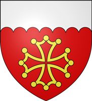
The Gard department refuses to pick a lane. It is a geographic contradiction that works. You think you are in deep Provence? Think again. You look west and see the rugged spine of the Massif Central. You turn east and the Mediterranean stretches out, blindingly bright. This isn’t just a scenic backdrop. It is a specific kind of chaos that defines the region’s identity.
A Mosaic of Three Worlds
The Gard sits at a crossroads of cultures and climates. Historically, it carries the weight of Languedoc, the flair of Provence, and the heat of the Mediterranean. These aren’t just labels thrown around by tourists. They are real, tangible influences that shape what people eat, how they speak, and what grows in the soil.
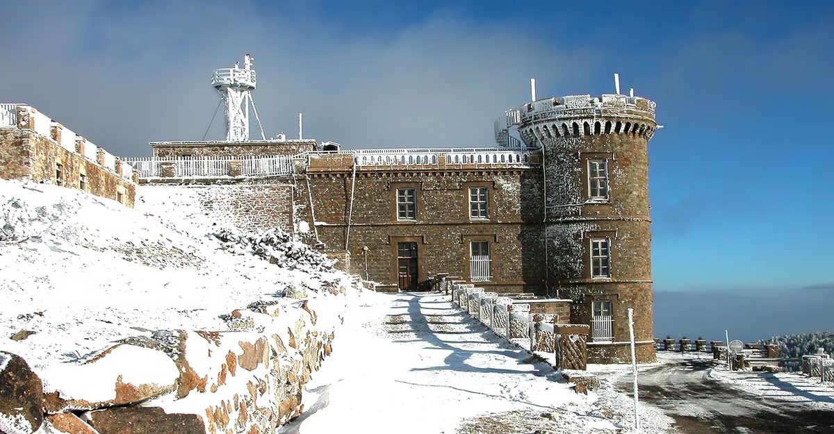
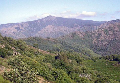
Geographically, the department is a study in contrasts. It spans from the misty peaks of the Aigoual mountain down to the dry, sun-baked tip of the Espiguette lighthouse. The journey is steep. You can start your day breathing air that smells of pine and damp earth in the mountains. By afternoon, you are navigating the scrubby, aromatic garrigue. By evening, the salt air of the coastal plain hits you. It is a mosaic. The sun doesn’t just shine here; it dominates.
This diversity creates a unique microclimate. The mountains block the harsh northern winds. The sea moderates the summer heat. The result is a landscape that feels both ancient and immediate. It is not a curated tourist trap. It is a working landscape where agriculture and nature clash and cooperate.
The Gard is not just a place on a map. It is a collision of ecosystems.
The Human Element
People who live here adapt to this verticality. A farmer in the Cévennes raises goats on steep slopes. A viticulturist in the Gardon valley tends to vines that struggle against the limestone. A fisherman in the Camargue edge deals with wild horses and flamingos. These aren’t separate worlds. They are connected by the same soil and the same relentless sun.
The department’s identity is fluid. It shifts depending on where you stand. Look north and you see resilience. Look south and you see abundance. The Gard embodies this duality. It is rough where it needs to be and gentle where it can afford to be. This isn’t a static postcard image. It is a living, breathing contradiction. And that is exactly why it matters. The tension between these landscapes creates a culture that is stubborn, proud, and deeply rooted in the earth.
The Big Four: How Agriculture Built the Landscape
If you look out at the southern French landscape, you aren’t looking at nature as it existed before humans got involved. You are looking at a curated exhibition of survival. The terrain is defined by just four botanical heavyweights: the chestnut, the mulberry, the olive, and the vine.
They didn’t just grow there. They forced their way in.
The chestnut (Castanea sativa ) provided the calories. It was the bread of the poor, a carbohydrate engine that allowed communities to settle in rugged, mountainous areas where wheat would have failed. You can still see the ghostly remains of chestnut forests in the Cévennes, carved into terraces that look like giant staircases built by giants.
Then there is the mulberry (Morus ). It sounds innocuous. It’s a snack for silkworms, essentially. But in the 17th and 18th centuries, it was an economic weapon. The French crown pushed for sericulture, planting mulberry trees everywhere to fuel a domestic silk industry. It wasn’t about beauty. It was about replacing Italian silk and keeping gold inside the kingdom.
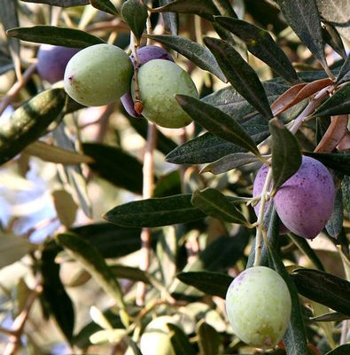
The olive (Olea europaea ) is the slow burn. It takes years to mature, decades to truly establish dominance. Its presence signals a specific climate tolerance—dry, hot summers and mild winters. It’s the oil of the ancients, the fat that preserved food and lit lamps when electricity was a distant dream.
But the vine? The vine is the artist.
Where Appellations Are Born
The grapevine (Vitis vinifera ) does something the other three don’t. It turns geography into brand identity.
In this region, the vine is the reason we have names like Côtes-du-Rhône, Costières-de-Nîmes, and Coteaux-du-Languedoc. These aren’t just poetic phrases slapped on wine bottles. They are legal boundaries drawn in the soil.
Why does this matter? Because it explains why a bottle from one side of a river tastes different than one from the other side. The appellation d’origine contrôlée (AOC) system locks these flavors into specific plots of land. It’s a map you can drink.
The Costières-de-Nîmes appellation, for instance, sits under the influence of the Mistral wind. That wind isn’t just a weather event; it’s a viticultural tool. It dries out the grapes, concentrating sugars and flavors while preventing rot. Without the wind, you don’t get the wine the region is known for. The landscape is the flavor.
Similarly, the Coteaux-du-Languedoc covers a vast stretch of varied terroir. Here, the distinction lies in the soil composition. Limestone? Clay? Schist? Each rock type drains water differently, stressing the vines in specific ways that translate to acidity or tannin structure in the glass.
Beyond the Label
We often think of these appellations as marketing tools. They are. But they are also historical records.
When you see Côtes-du-Rhône, you are looking at a landscape shaped by Roman irrigation projects and medieval monastic vineyards. The terraces you see? They were dug by hand over centuries. The stone walls? Built
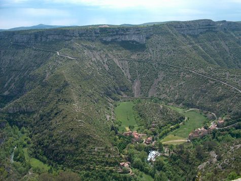
The Cévennes massifs and the limestone plateaus of the Causses, where sheep graze on the rugged terrain, are intertwined with the Causse Noir and the Larzac, the latter bordered by the breathtaking Navacelles cirque.
The Limestone Landscape
The Causses are a series of high limestone plateaus in southern France. They are part of the Massif Central, a region known for its dramatic landscapes and geological diversity. The limestone formations are a result of ancient seas that once covered the area, leaving behind layers of rock that have been eroded over millions of years.
The Role of Sheep
Sheep have played a crucial role in shaping the landscape of the Causses. Their grazing habits have helped to maintain the open grasslands, preventing the encroachment of forests. This pastoral tradition has been a defining feature of the region for centuries, influencing both the ecology and the culture of the area.
The Causse Noir
The Causse Noir is a specific plateau within the Causses region. Its name, meaning “Black Causeway,” refers to the dark color of the limestone and the surrounding vegetation. This area is known for its unique flora and fauna, including several species that are endemic to the region.
The Larzac Plateau
The Larzac is one of the largest plateaus in the Causses. It is limited by the Navacelles cirque, a dramatic geological formation that adds to the region’s scenic beauty. The Larzac is not only a natural wonder but also a place of historical and cultural significance. It has been home to various communities throughout history, including the famous AOP Roquefort cheese producers who use the region’s caves for aging their cheese.
The Navacelles Cirque
The Navacelles cirque is a striking geological feature that defines the boundary of the Larzac plateau. This amphitheater-shaped valley is a result of erosion and tectonic activity, creating a stunning backdrop for the surrounding landscapes. The cirque is a popular destination for hikers and nature enthusiasts, offering breathtaking views and a variety of outdoor activities.
Conclusion
The Causses, with their limestone plateaus and grazing sheep, are a testament to the intricate relationship between nature and human activity. The Causse Noir and the Larzac, with their unique geological features and cultural heritage, offer a glimpse into the rich history and diverse ecology of southern France.
The Romans didn’t just build roads. They built veins. The aqueduct of Nîmes is proof. It carried water from the spring at Ugie, near Uzes, across rugged terrain to the city gates. A distance of some 50 kilometers. The Pont du Gard stands as its most famous segment. But the real story lies in the garrigue itself. The scrubland that hugs the limestone hills. Here, the heat shimmers. The air smells of thyme and crushed pine needles.
Walking the route isn’t just exercise. It’s a lesson in Roman engineering. The gradient is subtle. Just 34 centimeters per kilometer. Enough to keep the water moving. Not enough to erode the channel. This precision allowed the water to flow constantly. No pumps. No electricity. Just gravity and geometry.
The Pont du Gard isn’t the whole system. It’s a bridge. A necessary crossing over the Gardon river. But the aqueduct continues on both sides. The structure uses arches to span valleys. Three tiers of them. The lower arches are wide. The upper ones smaller. This wasn’t arbitrary. It was structural necessity. The weight of the stone required a stable base. The Romans understood load distribution better than many modern builders.
Why does this matter now? Because it shows how infrastructure shapes civilization. The water fueled baths. It ran mills. It sustained a population of roughly 20,000 people. That’s not just survival. That’s luxury. That’s urban planning. The aqueduct enabled Nîmes to become a major provincial capital. Without that steady flow of water, the city shrinks. The culture stagnates.
The vegetation here tells a different story. The garrigue is dry. The soil is thin. Yet plants thrive. Lavender roots go deep. Cistus blooms in the sun. This landscape has resisted cultivation for centuries. It’s too rocky. Too steep. So humans left it alone. Nature took back control. The result is a mosaic of colors. Greens, browns, purples.
Visiting the site today means seeing layers. Ancient stone. Modern hiking trails. Tourist crowds in summer. But look closer. The channel itself. You can still see the sediment. The calcite deposits that formed over two millennia. Water left its mark. Not just on the stone. On the identity of the region.
Some argue the Pont du Gard is overrated. A photo op. But walk further from the bridge. Follow the trace of the aqueduct. You’ll find it disappearing into the hills. Less impressive? Maybe. More honest? Definitely. It shows the work. The cut stone. The tunnel through the rock. The siphons that dropped water beneath valleys. All of it hidden or buried. The bridge is the visible part. The rest is silence.
Néron gets credit for many things. But not this. The aqueduct predates him. It was likely completed under Augustus or Tiberius. Dates vary. Inscriptions are fragmented. But the scale is undeniable. The engineering is precise. The ambition is clear. The Romans wanted to conquer nature. Or at least bend it to their will.
The garrigue offers shade. And wind. And the sound of cicadas. A stark contrast to the silence of the ruins. Life continues. The plants don’t care about empires. They care about